Monday, January 26, 2015

Australia Day 2015

Happy Australia Day 2015!!!

Do you notice the people finding any shade they can?

I need a hat like that.


2015 Theme? Love this City, because Perth truly is one of the best cities in the world to live

 Flowers!

And the best part? Two minute walk home and not having to deal with this...

Saturday, January 24, 2015

NZ in the Rain Part 2

Happy Birthday to me,
Rainy kayaking in N. Z.,
Happy Birthday to me.

And I wouldn't have had it any other way.

This is Milford Sound.

The heart of Fiordland (not spelled Fjordland because they were worried the New Zealands would pronounce the "j"). The southwestern corner of New Zealand is almost inaccessible by road because of the fiords carved out by glaciers. Milford sound is the most touristy because you can get there by a road, though a tunnel in a mountain, that is closed for 4 days at a time in the winter because of avalanches.

The best way to see it is on the water. The best way to get on the water is via kayak. I knew that's what I wanted to do for my birthday.

But just like on the morning of our Tongariro crossing, I woke up at 5am to the sound of rain falling. Over the rivers and through the tunnel we winded our way to Milford.
 
 Luckily they had the gear to kit us out in the perfect summer kayaking outfits. Rain jacket, neoprene skirt, fleece jack, wool long underwear (tops and bottoms) and yes Amy, bathing suits underneath it all.
Turns out that despite the inability to see across the sound (actually a fiord but someone named it incorrectly and they couldn't be bothered to rename it) or the tour boats in the channel, rainy days (which are most of the days) are the best way to see Milford Sound. There are only two permanent waterfalls. When it rains, there can be hundreds coming down the granite cliffs, but the majority dry up within two hours after the rain. The granite cliffs are so steep that the forest, clinging on to the moss, falls off in tree avalanches!

The biggest of the waterfalls is Lady Bowen Falls which provides electricity and water that requires no filtering for the village of Milford. And just to put it into perspective, the height of Niagra Falls is 51 meters while the height of Lady Bowen Falls is 162 meters.
(It's much bigger up close!)


After three hours paddling around in the fog, it was time to dry off with the little shed's super power gas heater (I need one!) and head back to Te Anu. As we left the park, once again, the fog began to lift.

Due to the constant rain and my lack of waterproof camera, I only got to take limited pictures, but the experience as unforgettable.This is one birthday I will not forget any time soon.

How will I top it next year...?


PS. And back on dry land I was enveloped by a barrage of birthday messages and love to warm me up and thaw me out. A million thanks to all my friends and family from snow covered 40 degree Fahrenheit New England to sweltering 40 degree Celsius Australia.


Monday, January 19, 2015

NZ in the Rain Part 1

Now you may have noticed that the majority of the places we went in NZ had beautiful blue skies and sunny weather. For the two events that I had planned, however, the weather was anything but nice. There were two things that I wanted to do in New Zealand, and the first was the Tongariro Alpine Crossing.


"New Zealand's oldest national park and a dual World Heritage Site. The Tongariro National Park is rich in both cultural identity and dramatic, awe-inspiring natural scenery. Unique landforms, including the volcanic peaks of Ngauruhoe, Tongariro and Ruapehu ensure the Tongariro Alpine Crossing is considered a world-renowned trek.

The Tongariro Alpine Crossing is heralded as the best one-day trek available in New Zealand, while others say it ranks among the top ten single-day treks in the world.

Many who complete the 19.4-kilometre journey will tell you the climbs can be steep and the weather unpredictable, though worth it in every aspect."

The volcanic field is so spectacular that it was the site Mordor and Mt. Doom for Lord of the Rings.

There are Emerald Pools.
 

And a Blue Lake.

These are what I imagined New Zealand to be. These are what I came to see...
 
 I booked accommodation months in advance, arranged transportation to and from the trek, packed snacks the night before and went to bed in the sunlight of the night before (it's light until like 10pm).

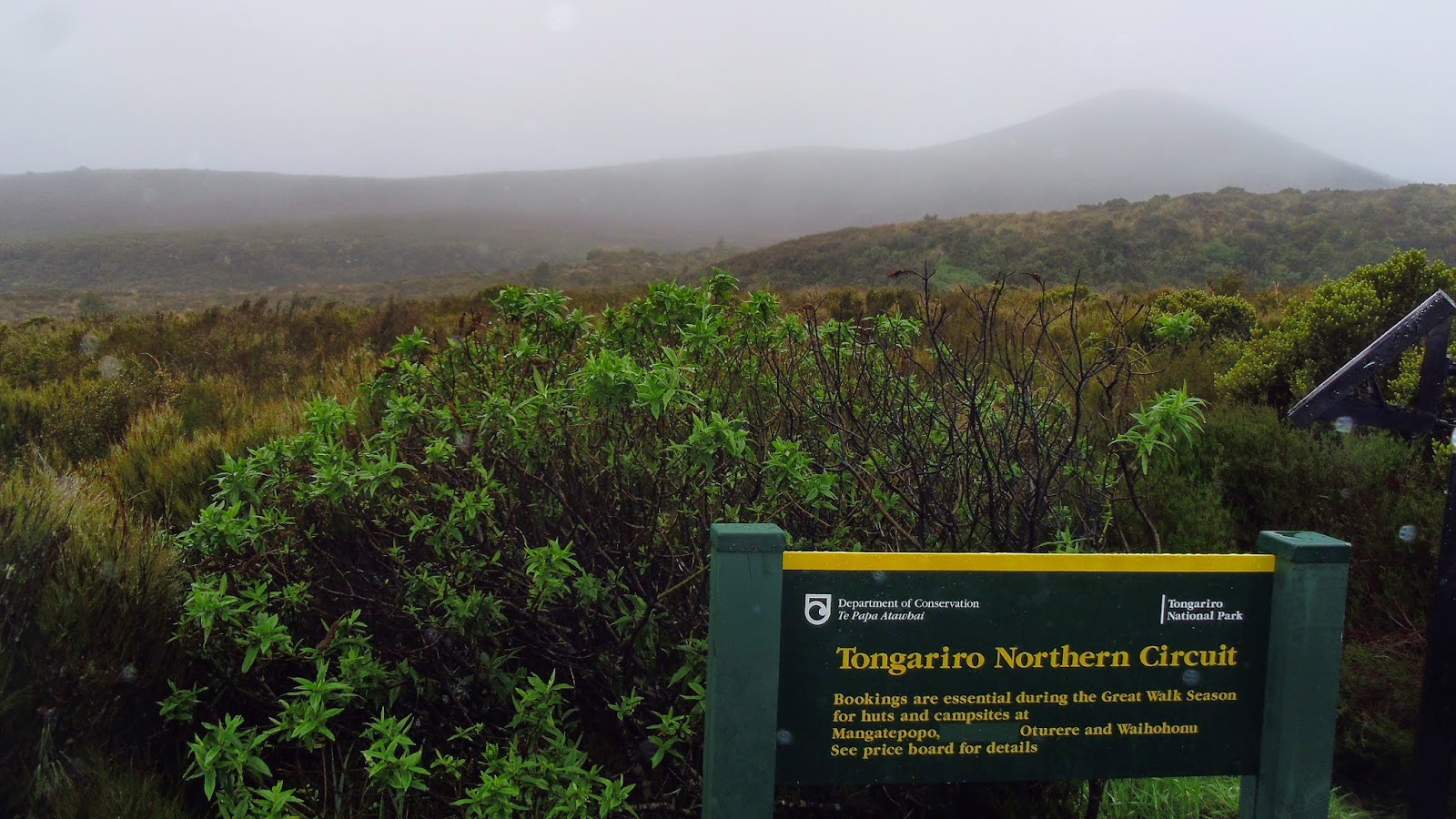
I woke up at 6pm to the sound of rain. The snow capped peaks you could see from National Park were hidden in dense fog. Fog so dense you could barely see across the road. I had read the this was a spectacular fair weather hike, and it looked like we'd be doing it in far from fair weather.

In the drizzle and fog we set out on our 20 kilometer hike.

Don't worry Mom, we got the green light!

The fog gave it all an eerie feel walking through the craters and old lava fields.


For about 5 minutes at the top of a steep climb, the mist cleared to reveal that were were on the ridge of a huge crater.
But the fog was back again came back over the ridge as we wandered our way to the summit of Mt. Tongariro almost 2000 meters straight up from sea level.

Then it was down the lava fields, carefully sliding through the black gravel, to the Emerald Pools.


We walked by an invisible Blue Lake to the east side of the mountains where we zigged and zagged along the alpine forested cliff. The sky did clear a bit as we made our way down to see Lake Taupo.
 By the time we made it out of the rainforest, the sun was shining, and looking back, the halo of mist around the peaks had disappeared. But not to despair too much, it returned not too short after.

Maybe I can come back to do it in the snow of winter (it's a popular thing too)...

But in the end, I saw everything I wanted to through the bonus of an ethereal lens. And it was all still very spectacular, perhaps my favorite thing in New Zealand. Not to mention it was a good day's walk, which I hear is good for your health...


Wednesday, January 14, 2015

New Zealand Part 2: The South Island

While the north island is known for it's thermal spas, Maori culture, and generally more people, the South Island is known for its majestic Southern Alps, adventure opportunities, and general lack of people. Both have verdant countrysides and very windy roads, but I think the spectacular views of the South Island speak mostly for themselves. 2,000 South Island kilometers later, I think I preferred the unpopulated wilderness of the western south. The contrasts of teal water, jagged coastlines, snow capped mountains and green temperate rainforests were breathtaking.

A river between Picton and Nelson

Murchison


The West Coast

Punakaiki (aka pancake rocks)


Franz Joseph Glacier

Waterfall along the Haast Pass through Mount Aspiring National Park

Driving through Haast Pass 
 

Queenstown and the Remarkables, where it was so crowded with holiday tourists we came and went.

 Fiorland National Park as the clouds cleared--more on this later!

The one bedroom motel in the farmlands of Tokanui

The Southern tip of New Zealand

Mclean Falls in the Catlins

The Catlin Coast
 For my dad!

The dry Central Otago with a selection of animal pelts

Omaru, a small town on the East Coast on the way to Christchurch...